Introduction
When it comes to understanding the geological composition of the Earth’s subsurface, borehole logs play a crucial role. A borehole log is a detailed record of the lithological and hydrogeological properties encountered during the drilling process. These logs provide valuable insights for various industries, including construction, mining, environmental assessment, and groundwater exploration. In this comprehensive guide, we will delve into the importance of borehole logs, their components, and how they aid in site assessment. Additionally, we will offer you a free AutoCAD template to optimize your borehole logging process and ensure accuracy in your projects.
What is a Borehole Log?
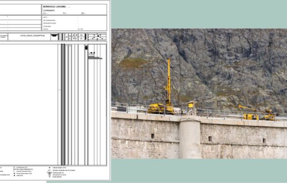
A borehole log, also known as a geotechnical log or a well log, is a systematic record of the subsurface materials encountered while drilling a borehole. Geologists, engineers, and environmental experts use this essential document to interpret the geological conditions of a site and assess its suitability for various purposes.
The Significance of Borehole Logs
Understanding Subsurface Geology
Borehole logs provide valuable information about the layers of soil, rock, and groundwater present beneath the surface. This data helps geologists create a stratigraphic profile of the area, enabling them to identify different geological formations and understand their characteristics.
Supporting Engineering Projects
Before commencing any construction project, engineers rely on borehole logs to determine the stability and load-bearing capacity of the ground. This information is vital for designing appropriate foundations and ensuring the safety and longevity of structures.
Evaluating Groundwater Potential
In groundwater exploration and hydrogeological studies, borehole logs assist in identifying aquifers, their depths, and potential yield. This data aids in sustainable water resource management and well design.
Environmental and Site Assessment
During environmental assessments, borehole logs are used to investigate potential contamination, evaluate soil and water quality, and plan remediation strategies for polluted sites.
Components of a Borehole Log
Header Information
The header section of a borehole log contains essential details about the project, such as the borehole’s location, drilling date, and the names of the geologist and driller involved.
Borehole Description
This part includes information about the diameter, depth, and inclination of the borehole. It also outlines the drilling method employed and any drilling difficulties encountered.
Lithology and Stratigraphy
The lithological section is the core of the borehole log, detailing the different types of materials encountered as the drilling progresses. Geologists describe the color, texture, and composition of the materials to identify geological formations.
Groundwater Levels and Sampling
In hydrogeological studies, groundwater levels are measured and recorded at various depths in the borehole. Additionally, water samples may be collected for laboratory analysis to assess water quality.
Geophysical Data (Optional)
Geophysical measurements such as resistivity, seismic velocity, or gamma ray logs may be included in the borehole log to further understand subsurface characteristics.
Downhole Equipment
This section lists the tools and equipment used during drilling, which can be critical for troubleshooting and quality control purposes.
The Borehole Logging Process
Site Investigation and Planning
Before initiating the drilling process, a thorough site investigation is conducted to select the most suitable locations for boreholes. Factors like geological diversity, accessibility, and project requirements are taken into account.
Drilling Operations
The actual drilling process involves the use of drilling rigs, which can be either manual or mechanical, depending on the project’s scale and complexity.
Data Collection and Recording
As the drilling progresses, geologists record the encountered materials, groundwater levels, and any other relevant information in the borehole log.
Laboratory Analysis
In some cases, soil and water samples collected from the borehole are sent to laboratories for further analysis, providing valuable data for site assessment.
How to Interpret a Borehole Log
Interpreting a borehole log requires expertise in geology and engineering. Geologists analyze the lithological descriptions and correlate them with known geological formations. Engineers use this information to make informed decisions about foundation design and construction methods.
Enhancing Borehole Logging with AutoCAD
To simplify and optimize the process of creating borehole logs, we are pleased to offer you a free AutoCAD template. This template is designed to help geologists and engineers accurately and efficiently log boreholes, ensuring precision and consistency in data recording.
Conclusion
Borehole logs are invaluable tools in understanding the Earth’s subsurface and play a crucial role in various industries. Whether it’s for construction, mining, environmental assessment, or groundwater exploration, the insights gained from borehole logs are irreplaceable. By utilizing the free AutoCAD template we provide, you can enhance your borehole logging process and contribute to more successful and sustainable projects.
So, embrace the depths, unlock the mysteries below, and make your drilling endeavors more informed and efficient with comprehensive borehole logs! Download our AutoCAD template now and take the first step towards achieving excellence in your geological and engineering pursuits. Happy drilling!
Download the Free AutoCAD Borehole Log Template Now!