In the world of geology and engineering geology, staying updated with seismic activity is not just a job; it’s a responsibility. With the constant threat of earthquakes, it’s crucial to have a reliable and feature-packed application that provides accurate earthquake warnings and maps. In this article, I will introduce you to the best application for earthquake warnings and maps on iOS – an app that I, as an experienced geology engineer, rely on for my seismic monitoring needs.
Understanding the Need for Earthquake Warning Apps
Before diving into the details of this exceptional iOS application, let’s discuss why such apps are essential for geology professionals and anyone living in earthquake-prone areas.
The Importance of Earthquake Warnings
Earthquakes can strike with little to no warning, leaving devastating consequences in their wake. Timely earthquake warnings can mean the difference between life and death. Professionals in the field of geology, like myself, depend on these warnings to assess potential risks and take necessary precautions.
Reliable Earthquake Maps
Accurate earthquake maps play a crucial role in understanding the impact of seismic activity. They help geologists and researchers analyze patterns, assess the vulnerability of regions, and plan for disaster mitigation.
Introducing the Top Earthquake App for iOS
When it comes to earthquake warnings and maps on iOS, one application stands out from the rest – the “Earthquake Alert” app. With over 4 million downloads and support for Apple Watch, it’s the go-to choice for those who take seismic activity seriously.

Key Features of the Earthquake Alert App
Here are some of the standout features that make this app the best in its class:
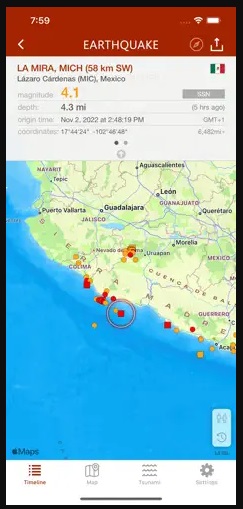
Rich Push Notifications
The Earthquake Alert app provides rich push notifications directly to your iPhone or iPad as soon as official earthquake data becomes available. What sets it apart is the ability to set up to 4 alerts based on location and magnitude threshold. As a geology engineer, this level of customization is invaluable.
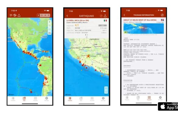
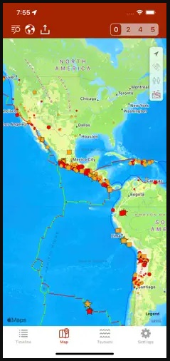
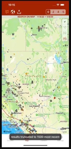
Interactive Earthquake Map
The app boasts an interactive map with different-sized and colored circles that represent the magnitude and age of earthquake events. This visual representation helps geologists quickly grasp the severity of seismic events.
Advanced Filtering Options
Filtering earthquake events by area (country or continent) or magnitude allows users to focus on specific data relevant to their needs. As a geologist, this feature enables me to hone in on areas of interest efficiently.
Multiple Data Sources
The Earthquake Alert app aggregates data from various reliable sources, including:
- U.S. Geological Survey (USGS)
- European-Mediterranean Seismological Centre (EMSC)
- GeoScience Australia
- GNS Science (GeoNet)
- Instituto Geográfico Nacional
- Servicio Sismológico Nacional
- British Geological Survey
- GFZ GEOFON
- Natural Resources Canada
- NOAA
Having access to multiple data sources ensures the highest level of accuracy and reliability in earthquake monitoring.
Ad-Free Experience
One of the most frustrating aspects of many apps is the presence of ads. Fortunately, the Earthquake Alert app is entirely ad-free, providing a seamless and uninterrupted user experience.
Event Timeline and Catalog
The app offers an event timeline, categorizing earthquakes by date, including today, yesterday, and previous days. Additionally, it maintains an extensive earthquakes catalog, covering all world regions since 2013. Users can search for earthquake data by date, territory, city, or reporting agency, making it an invaluable resource for geology professionals.
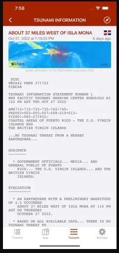
Tsunami Bulletins and Map Layers
Incorporating NOAA data, the app provides tsunami bulletins, adding another layer of safety and awareness. It also includes map layers that display tectonic plate boundaries, orogens, volcanoes, nuclear power plants, and population density. These layers are indispensable for geologists assessing earthquake risks and impacts.
Social Sharing and Data Export
The app supports social sharing, allowing users to share event maps and data via Facebook, Twitter, and Email. Additionally, users can export data to Google Earth or other apps that support the kml file format, facilitating collaboration and analysis.
Reverse Geocoding and Widgets
For locations with unavailable names, the app automatically calculates names from geographical coordinates. Widgets for the home screen or today view provide quick access to the latest seismic data, keeping users informed at all times.
Advanced Features
The Earthquake Alert app doesn’t stop there. It also offers advanced features such as:
- 3D Touch and Haptic feedback support
- Siri Shortcuts support for easy voice-activated earthquake updates
- “Critical Alerts” for crucial notifications
- “Dark Mode” support for a visually comfortable experience
Multilingual Support
Understanding the global nature of seismic activity, the app is localized in multiple languages, including English, Spanish, French, German, Italian, Greek, Russian, Chinese, Dutch, Portuguese, Turkish, Hungarian, Romanian, Korean, and Croatian. This inclusivity ensures that users worldwide can access and benefit from its features.
Why Choose the Earthquake Alert App?
As a seasoned geology engineer, I can confidently say that the Earthquake Alert app is the best choice for earthquake warnings and maps on iOS. Its extensive feature set, reliability, and user-friendly interface make it an indispensable tool for professionals in the field and anyone living in earthquake-prone regions.
How to Download the Earthquake Alert App
You can download the Earthquake Alert app from the App Store on your iPhone or iPad. Simply search for “Earthquake Alert” and install it on your device. Once installed, you’ll have access to real-time earthquake data and warnings right at your fingertips.

Conclusion
In the world of geology and engineering geology, staying informed about seismic activity is paramount. The Earthquake Alert app for iOS offers the most comprehensive and reliable earthquake warnings and maps available. With its rich feature set, user-friendly interface, and dedication to accuracy, it has earned its place as the top choice for professionals and concerned individuals alike.
Don’t wait for the next earthquake to strike without warning. Download the Earthquake Alert app today and stay ahead of the seismic curve. Your safety and preparedness depend on it.
Read more on blog:
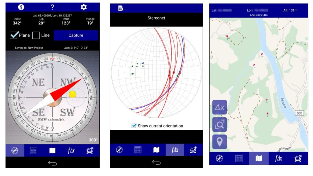
- 5 Best Geological Apps for iOS in 2023
- 5 Best Geological Apps for Android in 2023
- Discovering the Benefits of Free Geological Compass on Your Mobile Phone
- How to Construct a Geologic Cross Section: A Step-by-Step Guide
Guest author of the article: Mirza Djedović, B.Sc. geology