Geological compass App for Android and iOS: A Must-Have
In the ever-evolving world of geology, staying equipped with the latest tools and technology is essential for success. As a seasoned geologist, I can attest to the importance of having the right resources at your fingertips when conducting fieldwork or research. One such indispensable resource is the PocketTransit geological compass app for Android and iOS devices. In this comprehensive guide, I’ll delve into the features and benefits of this must-have app, ensuring that you’re well-informed about its capabilities and how it can enhance your work in the field.
What is PocketTransit?
PocketTransit is a versatile geological compass app designed for smartphones and tablets. Developed with the needs of geologists, geophysicists, surveyors, and field/mining engineers in mind, this app simplifies the recording and visualization of crucial geological data. With PocketTransit, you can effortlessly capture strike and dip measurements, trend and plunge values, traverse angles, and precise field site locations. Let’s take a closer look at the key features that make PocketTransit a game-changer for professionals in the field of geology.
User-Friendly Interface
PocketTransit boasts a user-friendly interface, making it accessible to both seasoned professionals and newcomers in the field of geology. Its intuitive design ensures that you can quickly navigate through the app’s various functions with ease.
The app features a five-tab user interface:
1. Compass Page
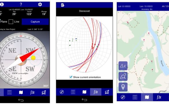
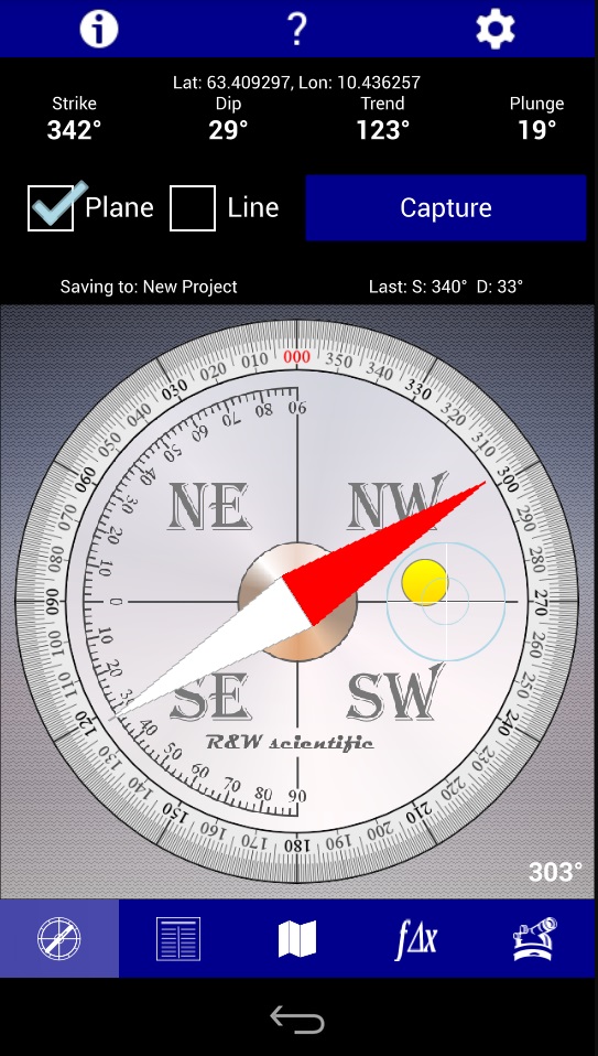
The Compass page provides a wealth of essential information at a glance. Here, you can access the compass azimuth, strike and dip measurements, trend and plunge values, as well as the precise location of your data points in latitude/longitude or UTM coordinates. Additionally, a clinometer display is included, aiding in accurate angle measurements.
2. Theodolite Page
On the Theodolite page, you can effortlessly capture horizontal and vertical angles while also recording location data. This feature comes in handy when you need to determine precise orientation angles in the field.
3. Projects Page
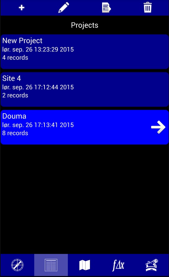
Organizing your data is a breeze with the Projects page. You can categorize your captured data into user-defined projects, simplifying data management. Review, edit, and export your data effortlessly, ensuring that your records are always organized and accessible.
4. Stereonet Page
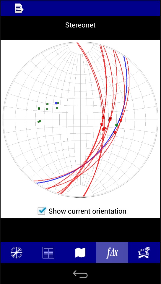
The Stereonet page allows you to visualize geological data in a three-dimensional context. It displays planes, poles, and lineations on a Wulff stereonet, providing invaluable insights into the orientation of geological features. You can also export the stereonet image for further analysis and documentation.
5. Map Page
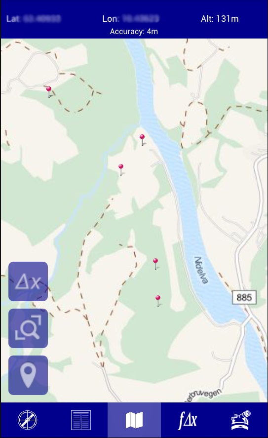
The Map page offers a visual representation of your data points on a flickable and zoomable map. Standard strike and lineation symbology is used to represent plane and lineation data, making it easy to interpret and analyze your findings spatially.
PocketTransitPro: Taking It to the Next Level
For geologists seeking advanced features and functionalities, PocketTransitPro is also available on Google Play. This enhanced version offers the following additional capabilities:
- Custom plane and lineation types: Tailor your data collection to your specific geological needs.
- Photo records: Attach images to your data points, providing visual context to your observations.
- Email export: Share your findings with colleagues and collaborators with ease.
- Rose-plot analysis: Gain deeper insights into geological data by utilizing rose plots to visualize trends and orientations.
FREE download for Android and iOS
Why PocketTransit Is a Must-Have Geological App
Now that we’ve explored the features of PocketTransit and its advanced counterpart, PocketTransitPro, let’s delve into why this geological app is a must-have for professionals in the field:
1. Efficiency and Accuracy
PocketTransit streamlines data collection, reducing the margin for error in your geological observations. With its intuitive interface and real-time data display, you can trust that your measurements are accurate and reliable.
2. Organization and Data Management
The Projects page ensures that your data is well-organized, allowing you to categorize and access information efficiently. This feature is particularly beneficial for ongoing research projects with multiple data points.
3. Visual Insights
The Stereonet and Map pages provide visual context to your geological data, enabling you to make informed decisions and draw meaningful conclusions from your observations.
4. Advanced Features in PocketTransitPro
For those who require advanced functionality, PocketTransitPro offers customizability, image integration, easy data sharing, and in-depth analysis tools, enhancing your geological research capabilities.
In conclusion, as a geologist with extensive experience in the field, I highly recommend PocketTransit as an indispensable tool for your geological endeavors. Its user-friendly interface, comprehensive features, and the availability of PocketTransitPro make it a must-have app for both seasoned professionals and aspiring geologists.
By incorporating PocketTransit into your toolkit, you’ll streamline your data collection process, enhance accuracy, and gain valuable insights into geological phenomena. Stay ahead in the world of geology with PocketTransit – the ultimate geological compass app for Android and iOS.
Note: For further information and to download PocketTransit or PocketTransitPro, visit the Google Play Store for Android devices and the App Store for iOS devices.
Read more on blog:
- 5 Best Geological Apps for iOS in 2023
- 5 Best Geological Apps for Android in 2023
- Discovering the Benefits of Free Geological Compass on Your Mobile Phone
- How to Construct a Geologic Cross Section: A Step-by-Step Guide
Guest author of the article: Mirza Djedović, B.Sc. geology
