By studying and mapping geologic structures the orientations of faults, folds, and tilted sedimentary formations, geologists can often reconstruct the original geologic setting and determine the nature of the forces that generated these structures. In this way, the complex events of Earth’s geologic history are unraveled.
Frequently, structures are so large that only a small portion is visible from any particular vantage point. In many situations, most of the bedrock is concealed by vegetation or buried by recent sedimentation. Consequently, reconstruction must be done using data gathered from a limited number of outcrops of exposed bedrock. Despite these challenges, a number of mapping techniques enable geologists to infer the shape and orientation of rock structures below the surface. In recent years this work has been aided by advances in aerial photography, satellite imagery, and the development of the Global Positioning System (GPS). In addition, seismic reflection profiling and drill holes provide data on the composition and orientation of rock structures that lie at depth.
What is Strike and Dip?
Sedimentary rock units, because they are usually deposited in horizontal layers, are most useful when studying rock deformation.
If the sedimentary rock layers are horizontal, geologists infer that the area is undisturbed structurally.
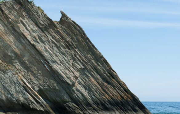
Inclined, bent, or broken strata indicate that a period of deformation occurred following deposition.
In the previous section you learned that geologists use strike (trend) and dip (inclination) to describe the orientation of planar rock features, such as sedimentary bedding and fault surfaces (Figure 1). In addition, by knowing the strike and dip of rocks at the surface, geologists can predict the nature and structure of rock units hidden beneath the surface.
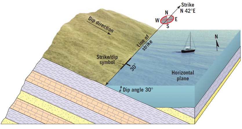
Strike is the compass bearing (direction) of the line produced by the intersection of an inclined rock layer (or fault) with a horizontal surface (Figure 1).
The strike is generally expressed as an angle relative to north. For example, N10°E means the line of strike is 10 degrees to the east of north.
Dip is the angle of inclination of the surface of a rock unit or fault, measured from a horizontal surface. Dip includes both an angle of inclination and a direction toward which the rock is inclined. In Figure 1 the dip angle of the rock layer is 30 degrees. The direction of dip is always at a 90-degree angle to the strike.
Mapping geologic structures
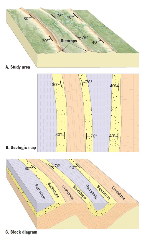
When doing field research, geologists measure the strike and dip of sedimentary strata at as many outcrops as practical (Figure 2A). These data are then plotted on a topographic map or an aerial photograph, using T-shaped symbols. In laboratories, this information, as well as notes about the rock units, is used to prepare graphical depictions of the study area, called geologic maps. Figure 2B shows a simplified geologic map of the study area. Geologic maps are valuable tools used to infer the orientation and shape of buried rock structures (Figure 2C). Using this information, geologists can reconstruct the pre-erosional structures and begin to interpret the region’s geologic history. Geologic maps are also used to aid in extracting mineral resources and assessing hazards, such as the potential for groundwater contamination from a proposed disposal site.