
In the world of geology, technology has revolutionized the way professionals and enthusiasts explore and understand the Earth’s composition. Mobile apps have become invaluable tools for geologists, offering a wide range of features that simplify data collection, analysis, and exploration. In this article, we’ll explore the top 10 mobile apps for geologists in 2023. These apps cater to the diverse needs of geologists, from field data collection to geological mapping and educational resources. So, whether you’re a seasoned geologist or just starting your journey into the world of rocks and minerals, these apps will undoubtedly enhance your geological experience.
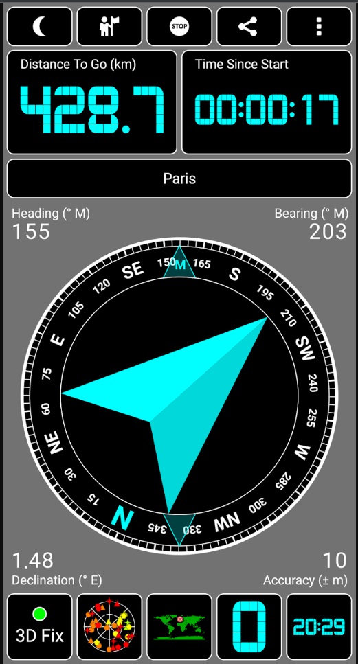
PocketTransit – Your Geologic Compass Companion
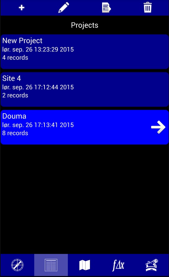

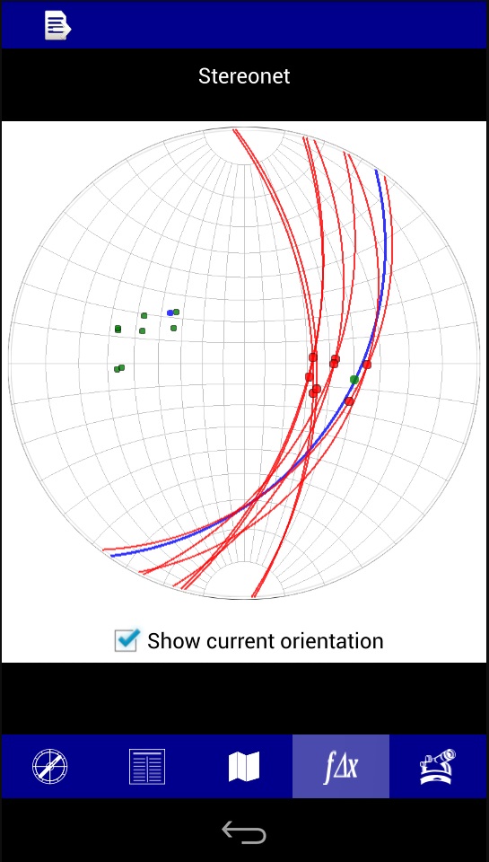
PocketTransit is the ultimate geologic compass app designed for professionals, geophysicists, surveyors, and mining engineers. This powerful app simplifies data collection, enabling you to record plane orientations, traverse angles, and field site information with ease. Here are some key features of PocketTransit:
Features
- Record strike, dip, trend, dip, and location data simultaneously.
- Visualize collected data in tabular, map, and stereonet forms.
- Export data to spreadsheet-compatible files.
- Utilize a five-tab interface, including compass, theodolite, project, stereonet, and maps.
- Clinometer display for precise measurements.
- Capture location data in latitude/longitude or UTM coordinates.
- Advanced version – PocketTransitPro, available on Google Play, offers even more features.
PocketTransit empowers geologists to efficiently gather and manage crucial geological data in the field.


Rock Identifier: Stone ID – Identify Rocks with Ease
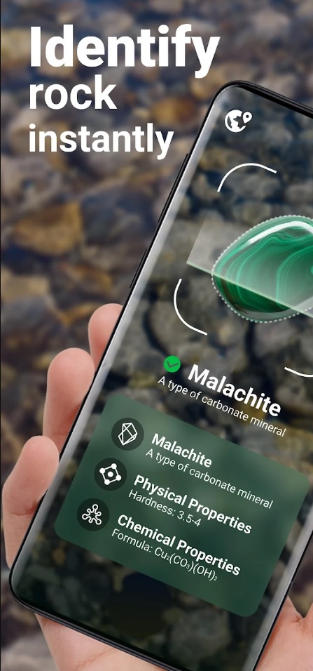
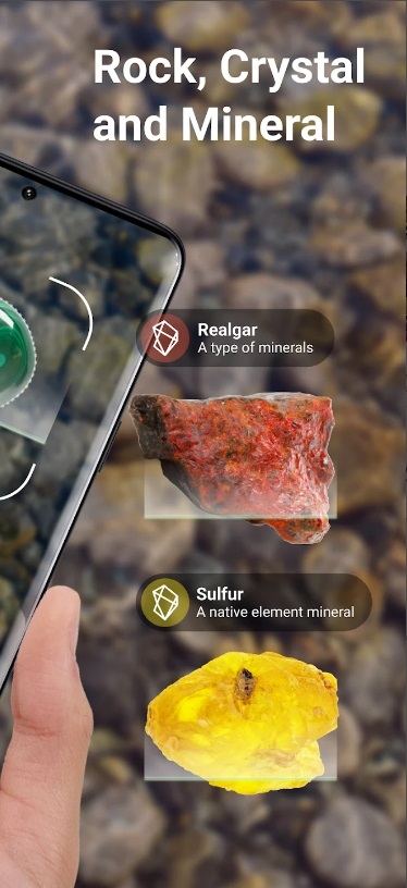
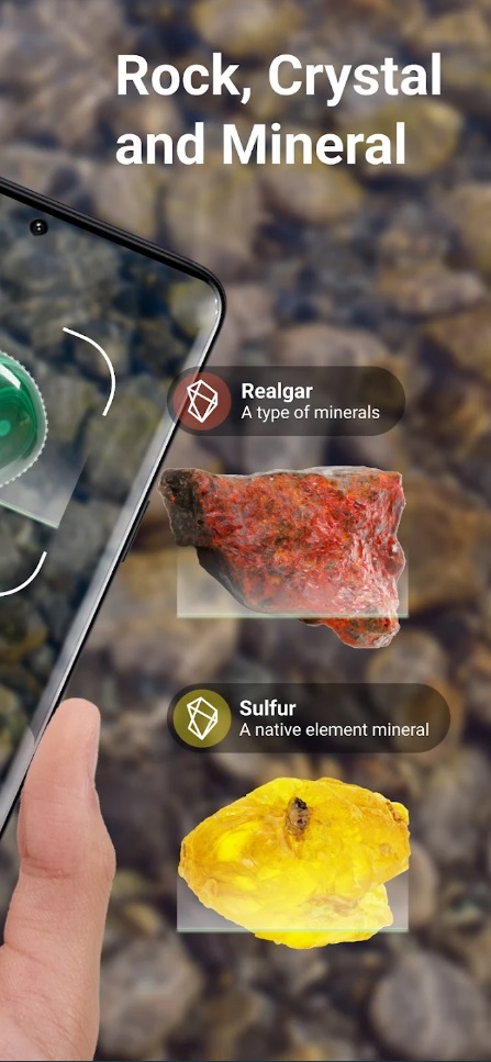
Are you curious about the rocks you encounter in your geological explorations? Rock Identifier: Stone ID is here to help. This app simplifies rock identification, allowing you to snap a photo and receive detailed information about the rock in seconds. Here are its key features:
Key Features
- Identify thousands of rocks with impressive accuracy.
- Access a wealth of resources to learn about rocks.
- User-friendly interface for easy navigation.
- Build your personal rock collection within the app.
- Search for over 6000 kinds of rocks.
- Add additional information, including location, date of purchase, price, and size.
- Explore various types of rocks, from raw stone to gemstones and crystal clusters.
Rock Identifier is an indispensable tool for geologists, mineral explorers, and anyone passionate about rocks.
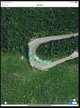
Rocklogger – Measure Rock Outcrop Orientations
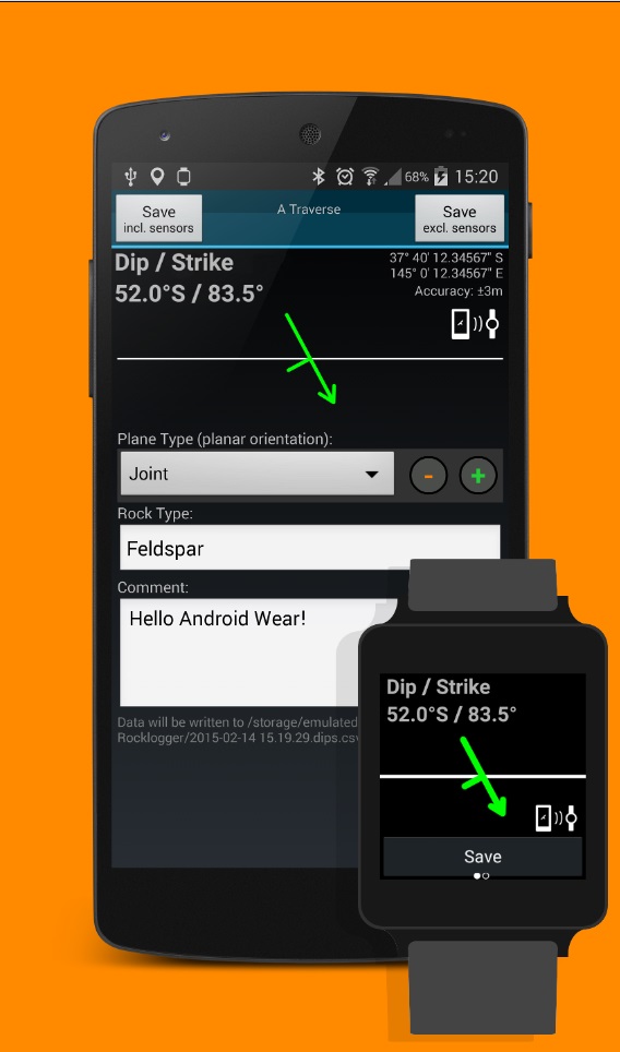
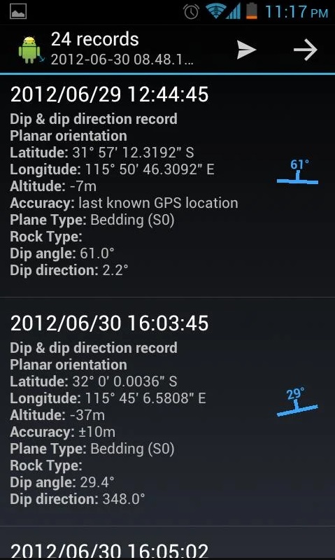
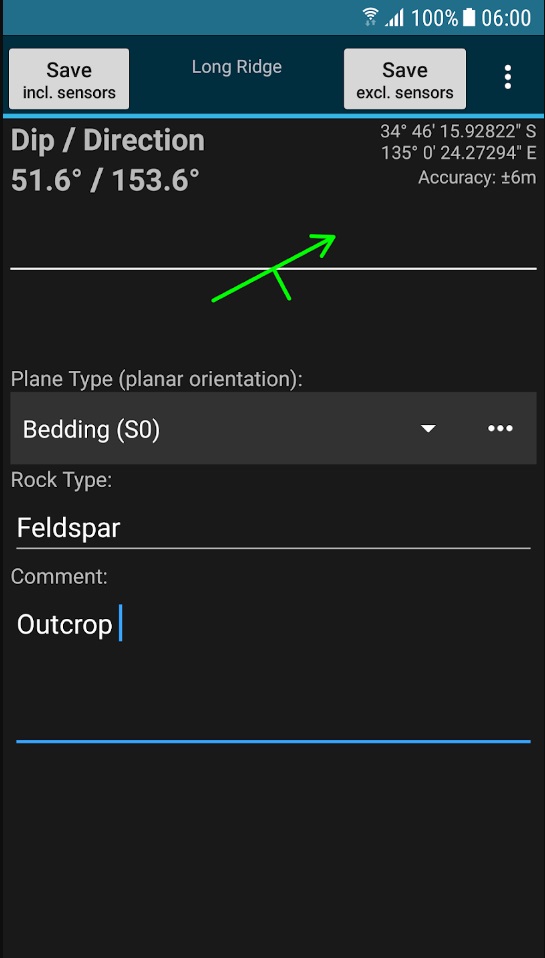
Rocklogger is a handy geological tool designed for measuring rock outcrop orientations. This app utilizes your phone’s compass and orientation sensors to measure dip, dip direction, strike, and more with just a single click. Key features of Rocklogger include:
Key Features
- Log dip, strike, and dip direction easily in any orientation.
- Android Wear companion app for remote logging.
- Plot logs on a map with correct dip and strike symbols.
- Customizable basemaps for in-depth analysis (paid version).
- Export data to .csv files for interpretation.
- Capture photos while logging, with notes and GPS data.
Rocklogger simplifies the process of measuring outcrop orientations, saving valuable time for geologists in the field.
Rockd – Explore and Document Geological Environments
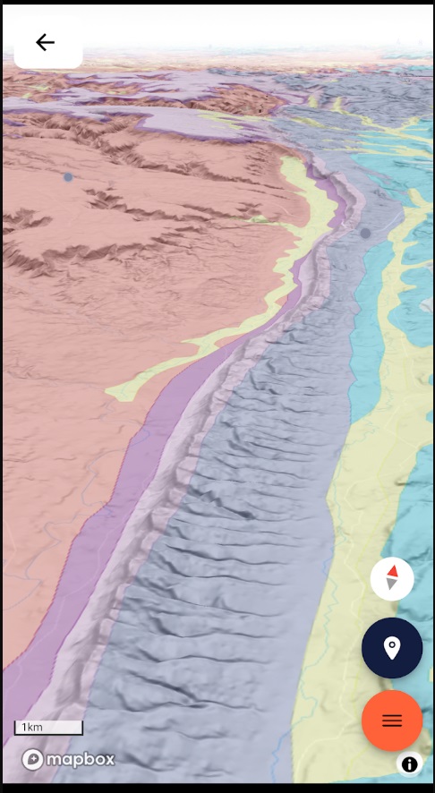
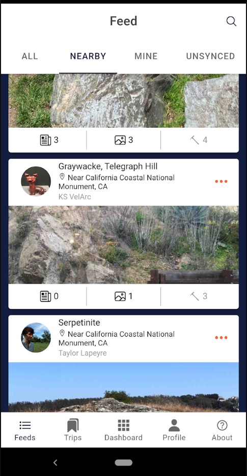
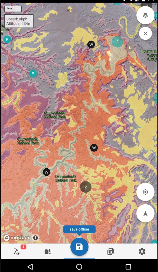
Rockd is your companion for exploring, learning about, and documenting the geological environment. Whether you’re a professional geoscientist or a rock enthusiast, Rockd provides a range of features to enrich your geological journey. Here’s what Rockd has to offer:
Features
- Instant access to geological and geographic summaries of your location.
- Interactive global access to over 140 geological maps.
- Explore past locations and paleogeographic maps.
- Access published literature with mentions of geological units.
- Record strike, dip, trend, and dip for geological features.
- Track your geological progress and share it with others.
Rockd is an invaluable tool for anyone passionate about geology, supported by the National Science Foundation.

GPS Test – Your GPS Reception Companion
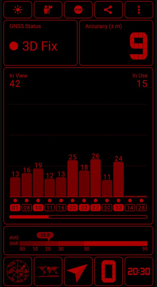
For geologists who rely on accurate GPS data, GPS Test is an essential app. It not only checks GPS reception in your area but also provides a wide range of GPS and sensor data. Here are its key features:
Key Features
- Check GPS reception and update AGPS data for faster fixes.
- View altitude, UTC and local time, compass direction, moon phase, and daylight.
- Support for multiple satellite systems, including GPS, GLONASS, GALILEO, and more.
- Customizable color schemes, including a night mode.
- Display GPS signal strength, accuracy, and network status.
- Coordinate grids and datums supported for precise measurements.
- Compatible with a variety of screen resolutions.
GPS Test ensures that geologists have access to accurate GPS data and sensor information for their work in the field.
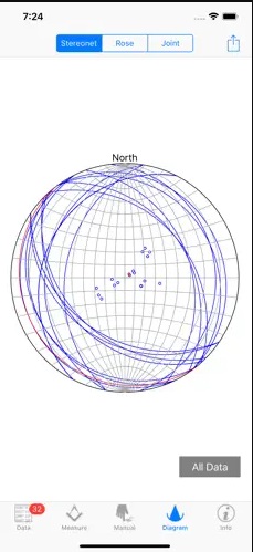
Stereonet Mobile – Collect and Analyze Geological Orientation Data
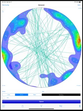
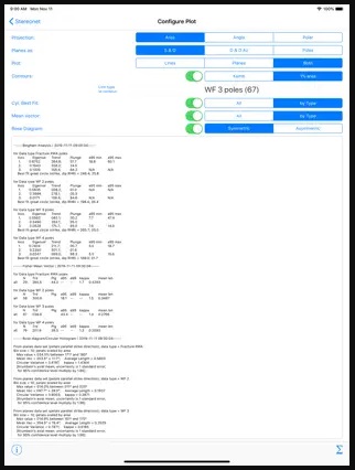
Stereonet Mobile is designed to assist geologists in collecting, visualizing, and analyzing geological orientation data. It’s a companion to the Stereonet program for desktop computers, offering essential functionality for geological analysis on mobile devices. Here’s what Stereonet Mobile can do:
Key Features
- Automatic data entry using the device’s orientation sensors.
- Manual data entry through tapping and dragging or text input.
- Plot lines and planes, tag them with user-defined data types.
- Perform essential calculations, including rotations and angle measurements.
- Plot mean vectors, cylindrical best fits, rose diagrams, and contour lines.
- Realtime changes to the stereonet projection for better understanding.
- Input and output data using standard iOS conventions.
- Works on both iPhones and iPads.
Stereonet Mobile is an indispensable tool for geologists who require precise geological orientation data.
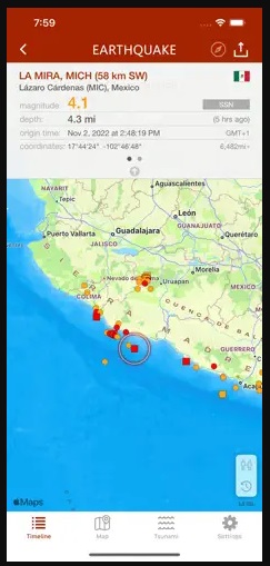
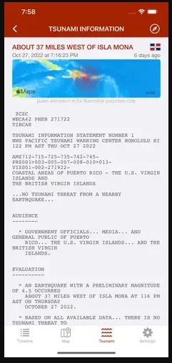
My Earthquake Alerts – Map – Stay Informed About Earthquakes
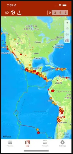
Geologists monitoring seismic activity will find My Earthquake Alerts – Map to be an invaluable resource. This app delivers earthquake information with push notifications, ensuring you stay informed about seismic events worldwide. Here are its features:
Features
- Live earthquake map tracking earthquakes worldwide.
- Free earthquake alerts tailored to your preferences.
- Powerful search to explore earthquake history.
- User-friendly design with map and list views.
- Detailed information about earthquake location, depth, and distance.
- Utilizes data from various earthquake networks, including USGS and EMSC.
Stay up to date with the latest earthquake activity with My Earthquake Alerts – Map.
Structural Geology – Learn About Geological Structures
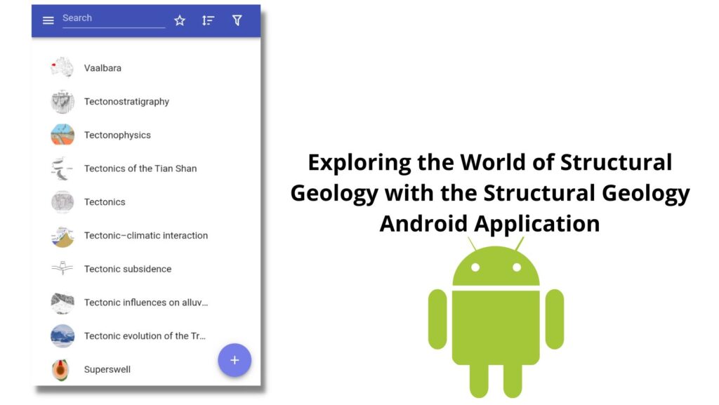
The Structural Geology app is a comprehensive resource for those eager to learn about geological structures. It offers a wealth of information on rock deformation, fault types, fold geometry, and more. Here’s what this educational app provides:
Key Features
- In-depth information on various structural geology topics.
- Interactive simulations and 3D models for better visualization.
- Access to tutorials and resources for self-paced learning.
- Comprehensive coverage of rock deformation, faulting, and folding.
- A valuable learning tool for students and enthusiasts.
Structural Geology empowers users to deepen their understanding of geological structures and processes.
FaultKin Mobile – Collect and Analyze Fault Slip Data

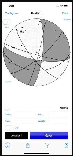
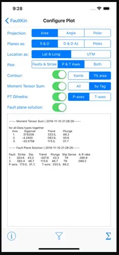
FaultKin Mobile is designed to help geologists collect, visualize, and analyze fault slip data. Whether you’re in the field or the lab, this app simplifies the process of recording geological data related to faulting. Here are its key features:
Key Features
- Automatic data entry using device orientation sensors.
- Manual data entry through tapping and dragging or text input.
- Assign tags to groups of faults based on criteria.
- Perform essential calculations, including rotations and angle measurements.
- Plot P and T axes, fault plane solutions, and more.
- Stamp entries with time and date, and optionally, location.
- Input and output data following iOS conventions.
FaultKin Mobile provides a convenient way to record and analyze fault slip data for geological studies.
Lambert – Your Geological Compass
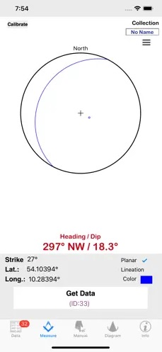
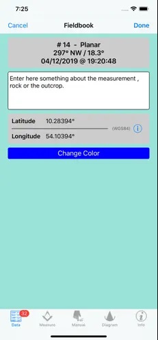
Lambert turns your iPhone or iPad into a geological compass, making it an essential tool for geologists. It measures the direction of dip and the angle of dip of geological strata, and even offers real-time stereographic projections. Here are the features of Lambert:
Key Features
- Measure dip and dip direction effortlessly.
- Real-time stereographic projection for visualization.
- Preview data in projection diagrams like Wulff and Schmidt Net.
- Add text to measurements and plot them on a map.
Lambert empowers geologists to make precise measurements of geological strata, enhancing their fieldwork.
Conclusion
These top 10 mobile apps for geologists in 2023 cater to a wide range of geological needs, from data collection and analysis to educational resources and earthquake monitoring. Whether you’re a professional geologist or an enthusiast, these apps will elevate your geological experience and make your work more efficient and enjoyable. Download them today and explore the fascinating world of geology with cutting-edge technology at your fingertips.
Read more on blog:
- 5 Best Geological Apps for iOS in 2023
- 5 Best Geological Apps for Android in 2023
- Discovering the Benefits of Free Geological Compass on Your Mobile Phone
- How to Construct a Geologic Cross Section: A Step-by-Step Guide
Guest author of the article: Mirza Djedović, B.Sc. geology