Predicting volcanic eruptions
Yes, it can, the technology has advanced enough, with the use of different methods for predicting volcanic eruptions, it is possible to get information when a volcanic eruption is expected. There are many methods, all of which can be used, but are best used in conjunction with each other.
Volcanic eruptions are usually heralded by precursor signs, such as an increase in shallow seismic activity, or ground deformation.
About 60 volcanoes erupt each year. A tenth of these eruptions finish within a day and some go on for years, but the average duration is about seven weeks.
How can you tell when an eruption is due, and how can you predict what its effects will be?
The best way to anticipate an eruption’s effects is to study previous eruptions. This is easy in the case of volcanoes that erupt every few years, because there are likely to be eyewitness reports, video recordings and so on that give you some idea of what might happen again. However, it is the volcanoes that erupt least frequently whose eruptions are usually the most dangerous, because a greater volume of ash and/or lava tends to come out in one go.
In such cases, there may be no historical records and the volcanologist must depend largely on the traditional skills of the field geologist – specifically, interpretation of past events based on detailed mapping and logging of ancient deposits. In addition, computers can predict the paths of ash, lava and mud flows on digital terrain maps. Hazard zone maps based on these approaches are available for many volcanoes.
Eruption precursors – reading the signs
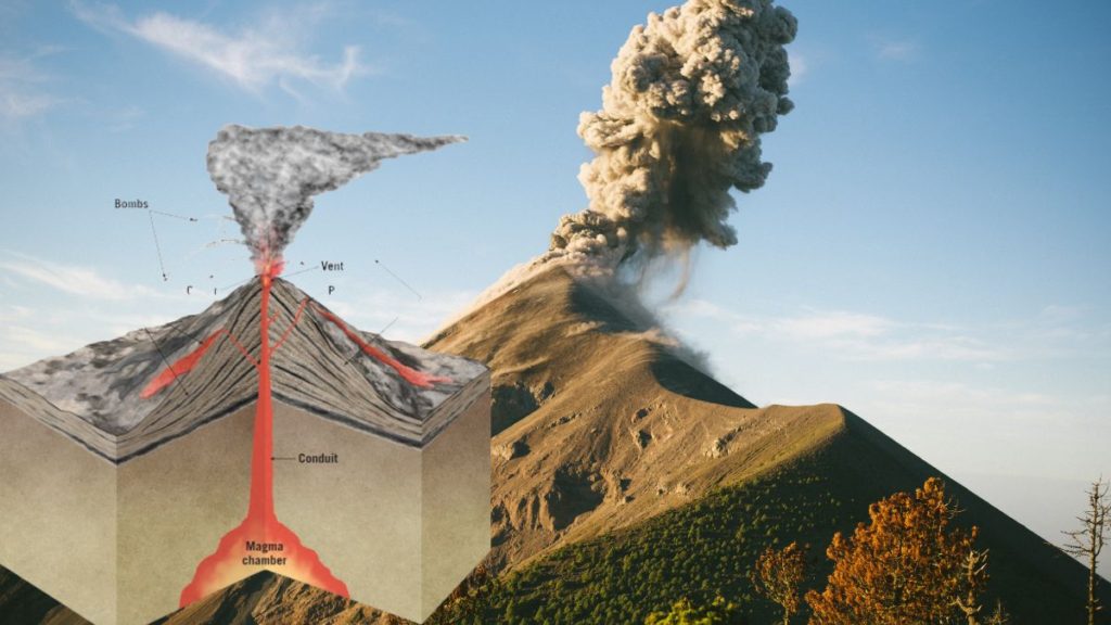
There are many possible precursor signs of an impending eruption. If recognized, these can give days’ or even months’ warning. This makes volcanoes easier to predict than tectonic earthquakes, in which, as you have seen, the first shock is usually the biggest. Probably the single most useful eruption precursors are special kinds of small earth tremors, readily distinguished from tectonic earthquakes, whose depth typically decreases from several kilometres to a few hundred metres during the build-up to an eruption. These are associated with injection of magma into the volcano, or with migration of gas bubbles. In order to pinpoint them, it is necessary to have an array of at least three seismometers on or close to the volcano.
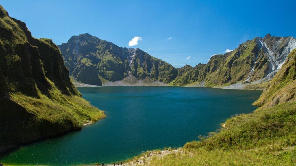
Seismometers are expensive instruments, and few volcanoes have permanent arrays. At the time of the first historic eruption of Pinatubo, Philippines, in 1991 the volcano had been little studied and was not under surveillance until a small ash eruption near the summit in March showed that it was waking up.
An array of portable seismometers was rushed into place, enabling the locations of sub-volcanic tremors to be tracked as they approached the surface. This gave enough notice for the most vulnerable areas to be evacuated before the catastrophic eruption in June. Most of the ensuing deaths were attributable to the failure to sweep fallout ash off flat roofs (which collapsed under the weight) and subsequent mudflows (lahars), rather than to lack of eruption warning.
When magma finds its way into a volcano, the volcano swells in size. In extreme cases, its contours may change by many metres. This deformation is another useful precursor sign, and its pattern may serve to indicate whether the eruption is likely to occur at the summit or from a vent or fissure on one side.
It can be studied by ground-based surveying or by using radar data from satellites. Other techniques include measuring tiny changes in gravity that reflect injection or withdrawal of magma from a volcano, measuring changes in the rate of gas emission or of gas composition, and monitoring changes in surface temperature using ground-based instruments or satellite-borne infrared detectors.
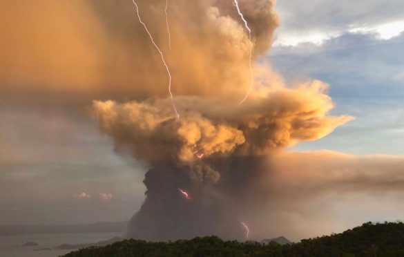
Sadly, precursor signs are not always enough to save lives in the case of small eruptions. On 28 September 2014, nearly 300 Japanese hikers were out and about on the flanks of Ontakesan volcano, a popular weekend venue. Seismicity increased only 11 minutes before a gas-driven explosion that generated a 3-km-long pyroclastic flow that claimed 56 lives. No warning was given, and even if it had been there would not have been time to evacuate the hikers.