What is geotechnical engineering?

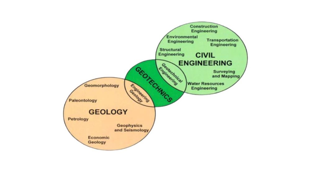
Geotechnical engineering is a branch of civil engineering that concerns the study of the interrelationship between the geologic environment and the work done by human kind.
Soil mechanics and rock mechanics are fields in which the mathematical aspects of analysis for the design of engineering works are defined and described as they relate to the geologic environment. Projects involving excavations in rock bear a close relationship to mining engineering.
The basis on which the knowledge structure of geotechnical engineering is built is a thorough comprehension of the elements of the geologic environment. In reality, therefore, geotechnical engineering consists of two major, but separate, disciplines: geology and civil engineering.

Both disciplines are branches of applied science, but there is a major philosophical difference between them. The geologist bases his conclusions primarily on observations and intuitive reasoning, whereas the engineer measures properties and applies mathematical analysis to reach his conclusions. The discipline of engineering geology (or geological engineering) has attempted to fill this philosophical gap, primarily in connection with the characterization of the geologic environment for construction works and the evaluation of geologic phenomena such as slope movements, earthquakes, etc., rather than in relation to the design and construction of engineering works such as foundations and retaining structures.
This website was conceived as a vehicle to create a merger between geology and civil engineering; it is a comprehensive guide to the elements of geotechnical engineering from the viewpoint of investigating and defining the geologic environment for the purpose of providing criteria for the design of engineering works—whether they are in soil or rock. The geotechnical engineer must be familiar with the many components of the geologic environment and its characteristics: rock types and rock masses, soil types and soil formations, groundwater as well as the phenomena generally referred to as geologic hazards, i.e., flooding and erosion, landslides, ground heave, subsidence and collapse, and earthquakes.

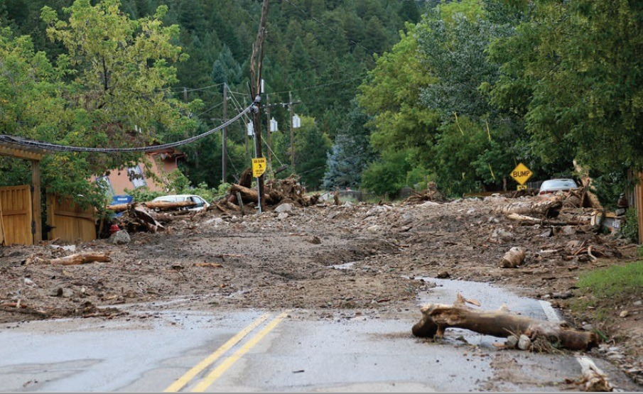
Debris flow in the Colorado Front Range
During the week of September 9–13, 2013, residents in and near Boulder, Colorado, received a harsh reminder of the dangers posed by debris flows. During that 5-day span, nearly continuous rainfall triggered numerous flash floods and more than 1100 debris flows in an area covering more than 3400 square kilometers (1300 square miles). Most occurred on steep slopes greater than 25 degrees.
While conducting geotechnical investigations it is necessary to identify these elements and to define their spatial orientation by employing various techniques of exploration. Engineering design criteria are established based on measurements of the hydraulic and mechanical properties of the component geologic materials, either through laboratory tests of samples retrieved from the field, or by tests in the field itself, i.e., in situ. The response of the geologic environment to changing stress fields or other transient conditions, occurring naturally or as a result of construction activity, is measured with instrumentation.

Oedometer cells for soil testing in a geotechnical laboratory
The most serious elements of the geologic environment that impact on the work by humankind are the geologic hazards, and approaches for dealing with these hazards. These phenomena are considered in terms of the degree of hazard that they pose and the degree of the risk of their occurrence. Solutions to these problems can follow one of several approaches: avoid the hazard, reduce it, or eliminate it. It must be recognized that in many instances it is not possible to totally eliminate a hazardous condition and it must either be avoided or reduced to the point where the risk is tolerable.
It must also be recognized that there are many limitations to our capabilities in geotechnical engineering. It is not always possible to define all significant conditions at a given location, to obtain accurate measurements of the properties of all geologic materials, or to predict, for example, the occurrence and magnitude of slope failures, floods, and earthquakes.
Many analytical approaches are based on empirical concepts, and most are based on concepts of elastic theory, which apply only in a general manner to most geologic materials.
An awareness of our limitations should lead to the adoption of conservative design strategies and the inclusion of adequate safety factors to provide for unknown contingencies.
