Lidar technology is a revolutionary sensing technology that uses laser light to measure and map the physical environment. It is an acronym for “Light Detection and Ranging” and is often referred to as “laser scanning.” Lidar technology has emerged as a key component of many advanced systems, including autonomous vehicles, drones, and smart cities. This technology provides accurate and high-resolution 3D images of objects, making it ideal for a variety of applications.
What is Lidar Technology?
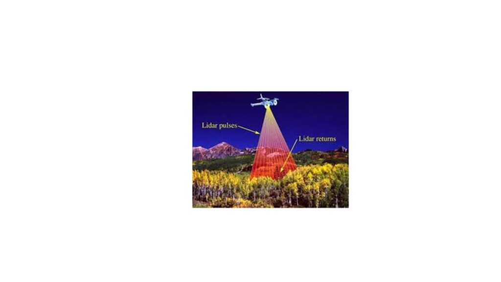
Lidar technology is a remote sensing technology that uses laser light to detect, measure, and map physical objects in the environment. It works by emitting a laser beam that reflects off of the object and returns to the sensor. By measuring the time it takes for the laser to bounce back, the sensor can determine the distance between the object and the sensor. This process is repeated thousands of times per second, creating a high-resolution 3D map of the object.
How Does Lidar Technology Work?
Lidar technology works by emitting a laser beam that travels through space and bounces off of objects in its path. The reflected light is then detected by a sensor, which measures the time it takes for the light to return. By calculating the time it takes for the light to return and knowing the speed of light, the sensor can determine the distance between the object and the sensor. The process is repeated multiple times per second, creating a high-resolution 3D map of the object.
Types of Lidar Technology
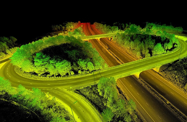
There are two main types of lidar technology: airborne lidar and terrestrial lidar. Airborne lidar is mounted on an aircraft or drone and is used to capture data from large areas, such as forests or coastlines. Terrestrial lidar, on the other hand, is ground-based and is used to capture data from smaller areas, such as buildings or archaeological sites. There are also different types of lidar sensors, including single-beam and multi-beam sensors, which are used for different applications.
Applications of Lidar Technology
Lidar technology has a wide range of applications across various industries. Some common applications of lidar technology include:
Mapping and surveying: Lidar is commonly used to create accurate and high-resolution maps of physical environments, such as forests, coastlines, and cities.
Autonomous vehicles: Lidar is a key component of many autonomous vehicles, providing accurate and real-time information about the vehicle’s surroundings.
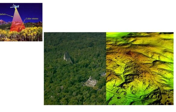
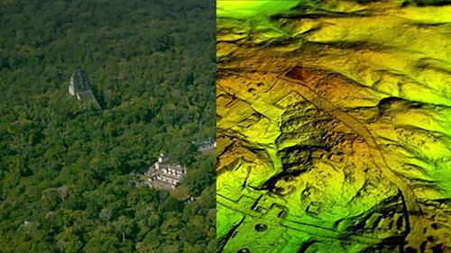
Archaeology and cultural heritage: Lidar is used to create high-resolution 3D models of archaeological sites and cultural heritage sites.
Construction and architecture: Lidar is used to create detailed 3D models of buildings, which can be used for design, construction, and maintenance.
Emergency response and disaster management: Lidar is used to create detailed maps of disaster-stricken areas, which can aid in emergency response efforts.
Advantages and Disadvantages of Lidar Technology
Advantages:
High accuracy and resolution: Lidar provides highly accurate and detailed 3D maps of physical environments, which can be used for a variety of applications.
Real-time data: Lidar sensors can collect data in real-time, making it useful for applications that require immediate feedback, such as autonomous vehicles.
Non-invasive: Lidar technology is non-invasive, meaning it does not require physical contact with the object being measured.
Disadvantages:
Cost: Lidar technology can be expensive, which can be a barrier for some applications.
Limited range: The range of lidar sensors can be limited, which can impact the size of the area that can be mapped.
Limited visibility in adverse weather conditions: Adverse weather conditions such as rain or fog can affect the performance of lidar sensors, making it difficult to collect accurate data.
Conclusion: Why and When to Use Lidar Technology?
Lidar technology provides highly accurate and detailed 3D maps of physical environments, making it an ideal sensing technology for a variety of applications. It is commonly used in mapping and surveying, autonomous vehicles, archaeology and cultural heritage, construction and architecture, and emergency response and disaster management. However, lidar technology can be expensive, has limited range, and can be affected by adverse weather conditions. Therefore, it is important to consider the specific application and the potential benefits and drawbacks of using lidar technology before deciding to implement it.